LUNAR GPS SYSTEMS
 LUNAR GPS NAVIGATION 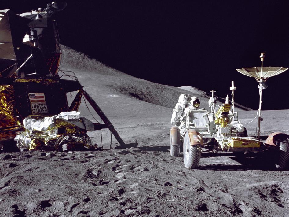 LUNAR GPS NAVIGATION I. Scientific/Technical/Management Section II. Servicing Concept with Constellation Systems III. Goals Pertinent to the Advancement of Science IV. Identification of Priority V. Development of New Technologies and Project Heritage VI. Risk Mitigation of Use with the Constellation System VII. Data Storage and References I. Scientific/Technical/Management Section The ability to use GPS for navigation on the lunar surface would allow astronauts the ability to travel over the lunar surface with GPS receivers attached to their lunar rovers. Two sets of GPS systems would be deployed during the next lunar mission with satellites on both sides of the moon allowing for navigation on both the dark and lighted sides of the moon. The Earth side GPS satellites would be positioned over the moon in a lunar geosynchronous orbit between the Earth and the moon, while the dark side lunar satellites would be positioned outside the orbit of the moon. The satellites would transmit with multi-functional data utilizing both Earth and lunar positions so both astronauts and people on the Earth’s surface would be able to use the data, although the data bases would be different. Astronauts using this system would be able to locate their landers and navigate around hazardous sites. The GPS could also improve safety locating rovers that may break down or become disabled in the rough lunar terrain. Data could be incorporated into the Lunar GPS system with present Lunar photography. Rendezvous of multiple rovers could be achieved after separate mission events. Below, the Apollo rover was navigated by visual reference and relied on Astronaut’s judgment, pre-planning and signals from Earth. With precision GPS the Astronaut will have a tool to enhance and bring safety and confidence to his lunar visit. 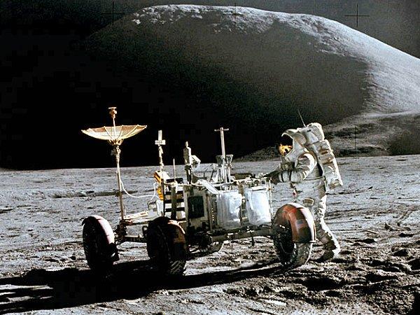 Apollo Mission Newer rover designs could be retrofitted with GPS equipment bringing in a new era of navigation in space. Lunar satellites would send their signals to modified dish antennae aboard their rovers.   II. Servicing Concept with Constellation Systems The deployment of the GPS satellites around the moon would be accomplished on separate rocket missions or during the first sets of orbits around the moon while the Astronauts are preparing for the deployment of the landers. Satellite orbits on the Earth side should be at an altitude above the moon to provide area coverage for the specific missions planned for the moon. So if the multiple missions are going to encompass 500 square miles of moon exploration then a cone of reception would cover this area with 4-5 satellites. Since the moon has no magnetic pole this could be the primary form of navigation with the secondary being dead reckoning by celestial navigation and pilotage. III. Goals Pertinent to the Advancement of Science Below is a display of a potential futuristic Garmin M.F.D. programmed for a Lunar Mission with data being transmitted from it’s Lunar Satellites. This data will include man made electronic intersections to provide direction and location. The goals of a navigation system for exploration would benefit the Astronauts and future missions into space. Here the satellites have detected an over voltage in the GPS System 1 telling the Astronauts to change over to one of 4 backup systems. Note in far right side of Lunar map the first Lunar Rt1.  LUNAR Route 1 Example IV. Identification of Priority Earth side: I. Earth side testing of concept with present lunar data in simulators. II. Design of satellites and rocketry for mission. II. Development of lunar rovers with equipment installed and tested with present Earth GPS systems. Lunar: I. Deploy satellites around the moon. II. Establish signal reception in rover equipment. III. Test navigational data in safe even lunar terrain. IV. Provide foundation for future missions of lunar exploration. V. Development of New Technologies and Project Heritage Since man has not used GPS on other planets or asteroids, experimentation of this kind of navigation on the moon would be essential to using GPS in other areas of the solar system. The challenge to improve navigation would bring on safety in exploration. Had Magellan,Columbus, Erickson, or Lewis and Clark been provided with this new marvel of electronics, the world would have been a lot easier to navigate. Not to explore is not human and it’s what drives the spirit to new heights. The heritage of this type of navigation is new in that it deals with a non rotating sphere and would require a new approach to satellite deployment and usage. The concept of stationary satellites is not new and orbital formulas are used every day over the Earth. VI. Risk Mitigation of Use with the Constellation System Like any new technology research, development and experimentation are costly and would require substantial investment. System simulator testing could reduce risks associated with mathematics and wavelengths. Incorporation into the Constellation system and development of a completely new data base would cost approximately 1.7 billion, giving the world the first electronic highway in space with Lunar Route 1. On Earth all roads lead to Rome on the moon all roads lead to eternity. VII. Data Storage and References Data storage could be shared or sold to private industry and could be classified as governmental or private if non governmental enterprises consider this mission. There are numerous scientific servers that can store the data here on Earth or in the future on the moon. Location of the Lunar servers could be placed near the lunar telescope. 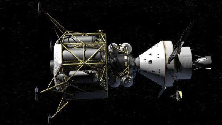 http://www.youtube.com/watch?v=-hqlzaf9uno http://news.nationalgeographic.com/news/2008/10/081023-new-lunar-rover.html http://www.theglobeandmail.com/news/technology/science/ottawa-to-study-building-canada-made-moon-rovers/article1918421/ http://www.google.com/images?q=lunar+rover&rls=p,com.microsoft:en-us:IE-SearchBox&oe=UTF-8&rlz=&um=1&ie=UTF-8&source=univ&sa=X&ei=D1hmTbrsG9OatweylKXmAw&ved=0CFMQsAQ&biw=1259&bih=806 http://www.satsig.net/pictures-of-satellites-gallery.htm http://en.wikipedia.org/wiki/Garmin_G1000 http://www.lpi.usra.edu/lunar/ http://www.lpi.usra.edu/resources/lunarorbiter/ http://www.lpi.usra.edu/resources/lunarorbiter/frame/?1031   This stunning cinematic event comes to us nearly 50 years in the making. Created from a newly discovered treasure of 65mm footage, and more than 11,000 hours of audio recordings, Apollo 11 takes us into the heart of NASA’s most celebrated mission – putting a man on the face of the moon. Featuring remarkable firsthand accounts and perspectives from the astronauts and team leading up to the great event, immerse yourself in this vivid experience that explores the giant leap that changed the world. 93 mins. Apollo 11- DVD Item # 705038 Unit Price: $34.95 Aerospace Systems and Training L.L.C. 260 North Industrial Drive PO Box 740263 Orange City, Florida 32763-9998 Support@Aerospacesandt.com  Walter Barry Principle Investigator Aerospace Consultation Aerospace Systems and Training L.L.C. WBarry@adminwb 1-386-801-3696 |